
Tracing a Norwalk Street by Address
Keep the original address beside any normalized form. Save street number, direction, name, type, unit, ZIP, ZIP+4, and alternate or crossing notation. Norwalk systems split these fields differently: My Norwalk uses Street Number, Alt#, and Street Name; DataScout Help uses street number, direction, and street name; the permit search uses PreDirection, Street Name, Street Type, and Unit. A mismatch can explain a missed result.
Move from address to parcel, then to the custodian. This keeps an assessment owner, deed party, voter result, and historical entry in separate roles.
- My Norwalk: enter Street Number, Alt#, and Street Name; save property, school, voting, and council outputs.
- MapGeo: locate the parcel and layers; save the map date and warning.
- ACT DataScout: carry the parcel or property ID; save displayed owner, mailing, situs, tax map, and transfer leads.
- Town Clerk index: search grantor, grantee, instrument, and book/page; request the full instrument.
- Voter lookup: note returned status, address, search date, and any blocked or no-match response.
- History Room: compare the street and address in a dated directory or newspaper; treat it as historical.
Norwalk Street Directory by Address
Norwalk has no current county recorder or county clerk. Town clerks perform the local recording role, so a street chain branches from the Town Clerk to assessment, GIS, permits, voter, and library sources. These records answer different questions.
| Address-keyed source | Custodian | Street clue | Route |
|---|---|---|---|
| Assessor field card | Norwalk Assessor | Owner, mailing, situs, parcel/PID, tax map | DataScout or terminal |
| GIS parcel layers | Norwalk GIS and WestCOG | Parcels, abutters, aerials, public layers | MapGeo or request |
| Deeds, liens, and maps | Norwalk Town Clerk | Grantor/grantee, instrument, date, book/page | Index or counter |
| Voter status | Norwalk Registrar and Secretary of the State | Name, address, status, party choice | Lookup or registrar |
| Permits and code cases | Building and Code Enforcement | Permits, COs, complaints, violations | Portal or request |
| Dated directories and news | Norwalk Public Library | Historical address, household, street clue | Microfilm or request |
Use parcel/PID as the handoff key, but keep situs, mailing address, ZIP, and historic locality separate. Save the URL, query form, search date, result date, book/page or map reference, and portal disclaimer.
Norwalk Street Directory DataScout Fields
Current Norwalk property search uses ACT DataScout. Norwalk’s December 19, 2025 notice says Vision/VGSI was replaced, with redirects effective January 16, 2026. Use the current route rather than an old bookmark.
The live Norwalk form returned 403. Required marks, choices, sorting, pagination, exports, and coverage notice were not machine-readable. DataScout Help and the field card are the verified substitutes.
| Documented field | Street-record use |
|---|---|
| Owner name first or business name | Owner or organization search. |
| Owner name last | Surname follow-up. |
| Parcel number and property ID | Keep dashed parcel and numeric ID separate. |
| Street number, direction, street name | Three address parts; Help does not include street type. |
| Subdivision and S-T-R | Named subdivision or section-township-range. |
| Property type | All Property Types; Improved & Vacant. |
| Transfer and mailing address | Sale data, grantee/deed location, warranty deed, land sale, mailing search. |
| View and Map | Open the result and map context. |
Note: The live Norwalk DataScout form returned 403, so Help fields and a dated field card remain the verified public reference.
Norwalk Street Records: Four Terms
These four terms keep Norwalk map clues, assessment data, deeds, and dated directory entries in separate lanes.
- Parcel
- A mapped tax or assessment unit identified by a parcel number or PID, not a deed or survey.
- Situs address
- The physical address shown for a parcel, separate from mailing and historic addresses.
- Plat
- A subdivision or survey map showing lot layout; a map alone does not transfer title.
- Criss-cross directory
- A dated reverse-address aid connecting a street address to a printed household or organization entry.
Keep the original spelling beside the normalized form, and do not turn a ZIP, neighborhood, taxing district, mailing line, or map label into a parcel boundary.
Norwalk Land Records and Deed Chain
The Norwalk Town Clerk land-record office is at 125 East Avenue, Room 102. Public hours are 8:30 a.m. to 4:00 p.m.; phone 203-854-7747. Connecticut has no current county recorder, so this is the first local stop for deeds and other instruments affecting a Norwalk parcel.
Indexed families include attachments, conveyances, deeds, judgments, liens, tax liens, maps, mortgages, and other legal instruments. CGS 7-25 requires grantors and grantees to be entered alphabetically and cross-indexed with instrument nature, date received, and book/page or a suitable location. The index is a search aid, not the full instrument.
Search both party roles, compare spelling variants, and carry forward every book/page. Check later mortgages, assignments, releases, liens, judgments, maps, corrective instruments, and conveyances before calling the chain complete.
The Town Clerk land-record source gives the local recording scope and address-trail route.
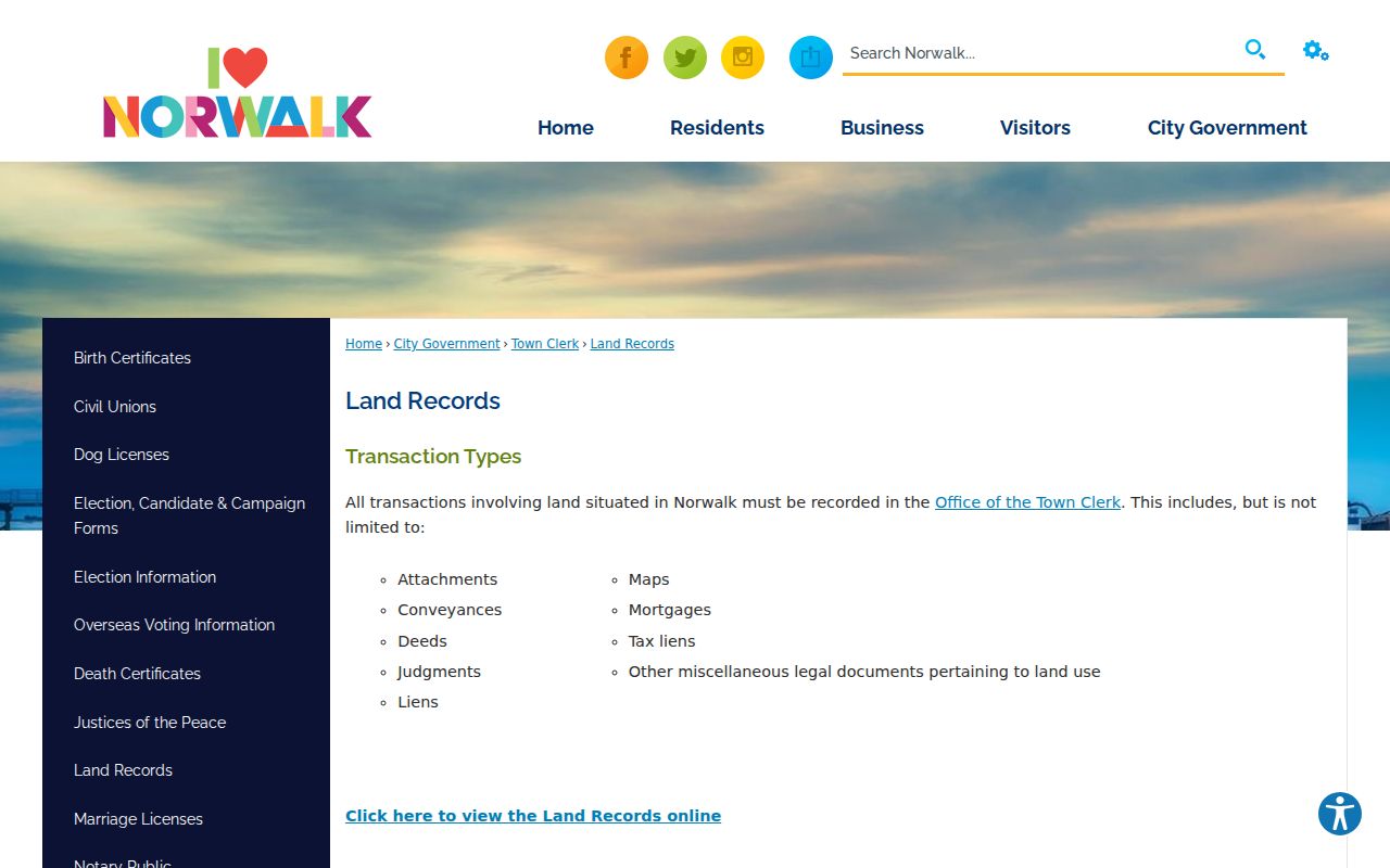
The image supports the office handoff: use the online index for a lead, then ask the Town Clerk for the underlying instrument or certified copy when the record matters.
Norwalk Street Directory Land Index
The current public index is NorwalkLandRecsPublic. It supports grantor, grantee, instrument, book, and page research, but current labels, tabs, sorting, pagination, and downloads were not machine-readable during inspection.
An inspected card shows parcel 5-23-10-0, PID 13598, displayed owner and mailing data, situs, tax-map information, and a Book 705/Page 165 lead. That reference points to the Town Clerk, not the deed. The card says “Not a Legal Document; subject to terms.”
Copies are $1 per page; certification is $1 per page plus $2. Record request, payment, instrument, date, parties, and book/page separately.
The public Norwalk land-record index is the address-to-document search surface.
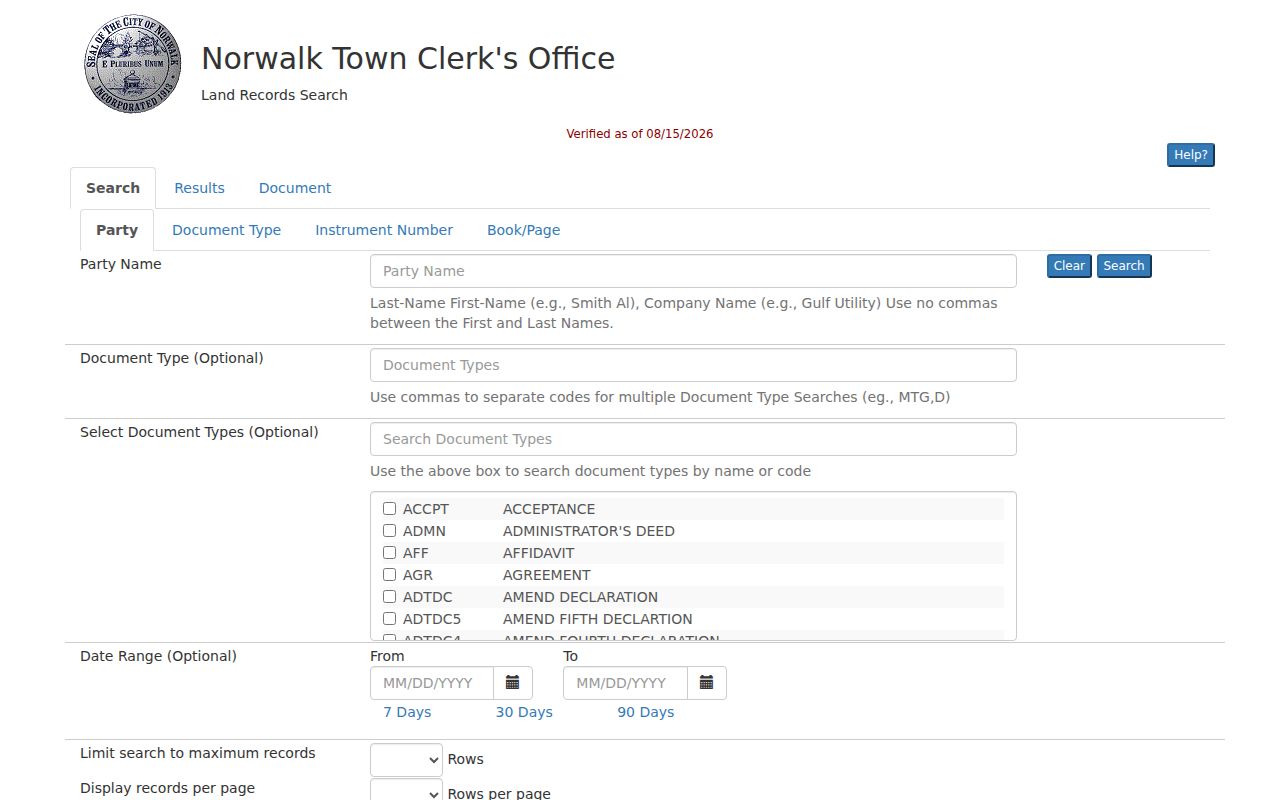
Use the visible result as an index lead, then verify the text, map, and party roles in the Town Clerk record before sharing a conclusion.
Note: A field-card reference can point to a deed, but only the Town Clerk instrument establishes what the recorded document says.
Norwalk Street Directory Assessor Cards
The Norwalk Assessor is at 125 East Avenue, Room 106, with public terminals, tax maps, property cards, the city street index, and sales indices. Phone 203-854-7888. A card gives assessment context, parcel/PID, displayed owner and mailing data, situs, acreage, tax map, transfer, and building facts. It is not a legal document.
A sample card lists parcel 5-23-10-0, PID 13598, 4.44 acres, assessor map 11SE, 238 WEST ROCKS RD, and a Book 705/Page 165 lead. It separates land, improvements, outbuilding, assessed value, and fair-market value. Copy the card date with those fields.
Use the card when DataScout is blocked or an old Vision/VGSI link redirects. Call, visit the terminals, or provide the parcel/PID or exact situs. Keep the displayed owner role separate from residence.
The Norwalk Assessor source supplies the office and terminal route.
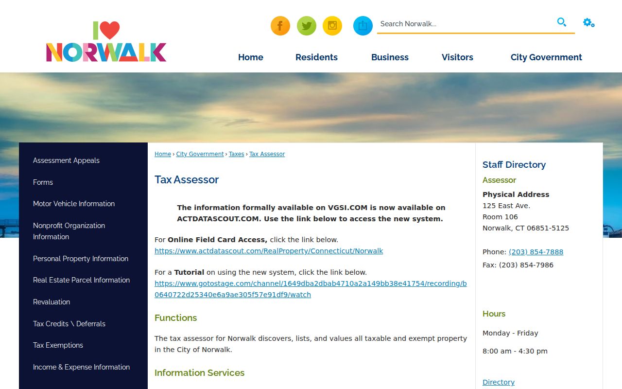
The image belongs beside the address workflow because the field card supplies the parcel and deed references needed for the next verification step.
Norwalk Street Directory GIS Maps
Use the WestCOG MapGeo Norwalk viewer for parcels, adjacent shapes, and public layers. Norwalk describes annual layer updates and aerial imagery every five to seven years, so save the map date.
GIS is a convenience display, not a survey or legal boundary source. If it conflicts with an assessor card or deed, preserve each date and escalate to the Town Clerk or survey source.
For fallback data, contact GIS@NorwalkCT.gov or request CAD, Shapefile, PDF, JPEG, geodatabase, or another format. The request can name a street, intersection, parcel ID, feature, boundary, map lookup, parcel layer, easement, utility, building, or orthophoto year.
The Norwalk GIS source gives the viewer and data-request route.
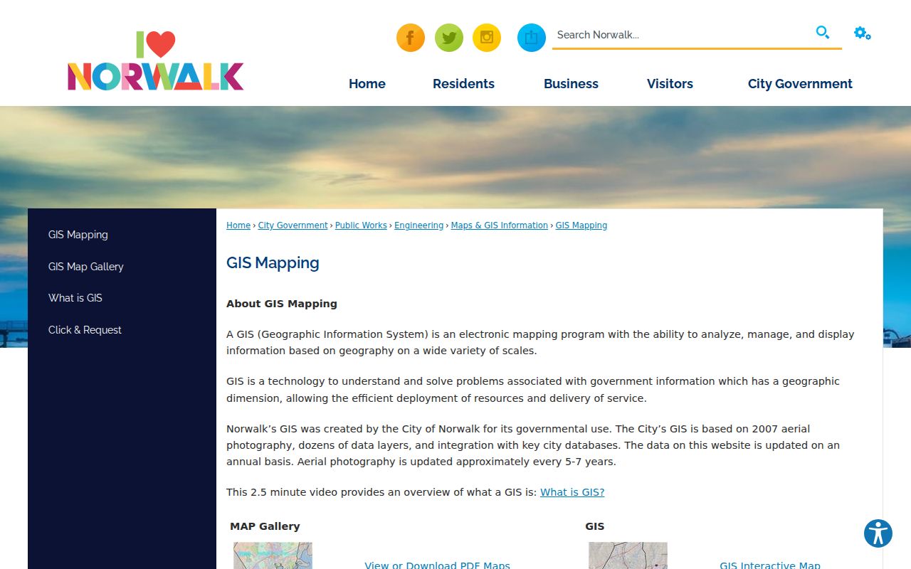
MapGeo is most useful in the handoff between an address and a parcel. It should not be cited as proof of title, a survey line, or a current household.
Norwalk Permits and Code Records by Address
The Norwalk permit portal accepts Street Number, PreDirection, Street Name, Street Type, Unit, Contractor, and APN. Use the parts separately for a partial address or known parcel. Its research record does not state a complete start year or retention period, so a blank result is not proof that earlier work is absent.
For follow-up, Norwalk Building and Code Enforcement is at 125 East Avenue, Room 123, open 8:30 a.m. to 4:00 p.m.; phone 203-854-7755. The route covers permits, certificates of occupancy, complaints, violations, unsafe buildings, demolitions, pools, signs, and tents. Request the exact permit, CO, or open-work history.
A permit shows a city action tied to an address, not every change or an owner. Keep the APN, address form, request date, result, and delivery notice together.
The Norwalk permit and property search shows the address fields used for the property-history handoff.
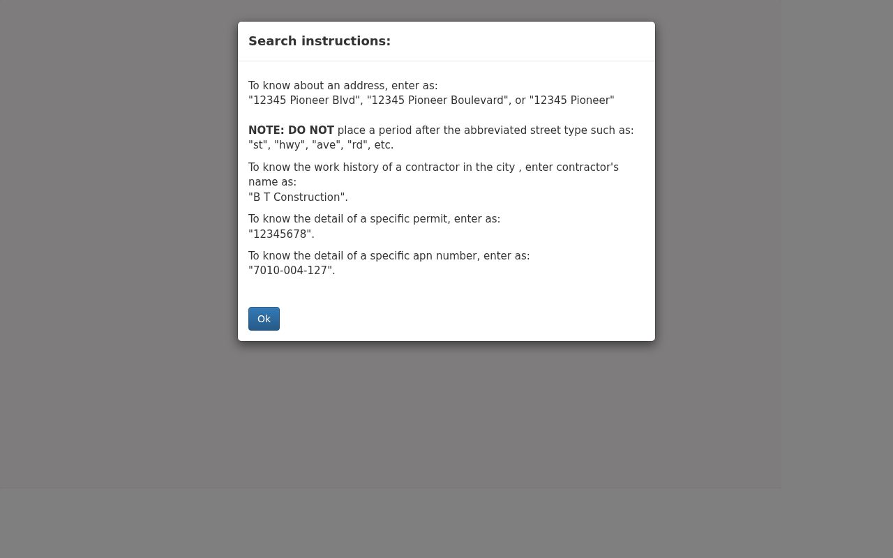
The image keeps permit research tied to the address rather than blending a permit record with an owner, voter, or directory result.
Norwalk Historic Street Names and 1913
A Norwalk address can carry an older civic label. Norwalk, South Norwalk, and East Norwalk were distinct terms before the 1913 consolidation. Search the original label with Norwalk, then compare date, street, map, and parcel.
The city seal links the bridge to old Norwalk and the First Taxing District, the Old Well to South Norwalk and the Second, and the Roger Ludlow monument to East Norwalk and the Third. Rowayton, Silvermine, Cranbury, West Norwalk, Wolfpit, Golden Hill, and Broad River are search terms, not legal jurisdictions.
The official Norwalk street map supplies a street index and grid, including Indian Spring Road L3 and Ingalls Avenue K4. NorWALKer adds local walking orientation for Downtown, Silvermine, South Norwalk, and West Norwalk. Return to parcel sources.
Norwalk Voter Status and Address Clues
Norwalk’s voter instructions point to a state lookup for name, address, current residential address, active status, and party choice. It is not a street roster or proof of ownership. The state form returned Request Rejected or bot during research, so exact controls and non-match messages remain a gap.
Use the Norwalk voter instructions and Registrar route for correction or district context. The listed phone is 203-854-7996. Save lookup date, town, election context, and active, inactive, or no-match status.
Do not reconstruct a protected address. Connecticut’s Address Confidentiality Program, or Safe at Home, can substitute a mailing address and protect an eligible participant’s physical location. Voter privacy under CGS 9-50(d) and ACP are separate from parcel research.
Norwalk ZIP Codes Versus Parcel Geography
Official USPS material lists Norwalk labels 06850 through 06858. Use the USPS Postal Bulletin, then enter the full address in the USPS ZIP lookup. Save ZIP, ZIP+4, recommended city, and search date. A ZIP is not a parcel, neighborhood, school, or voting boundary.
USPS delivery geography differs from Census ZCTAs, which approximate ZIP areas for statistics. Use the Census Norwalk search for the table’s ZCTA and vintage, and USPS for the exact address.
06859 is historical because USPS recorded its 2017 movement to 06854. Do not use it in a current match without checking the address. My Norwalk, the Assessor, GIS, or Town Clerk must connect a ZIP result to a parcel.
Note: A ZIP narrows a search; an exact address connects it to a Norwalk parcel.
Norwalk History Room and the Human Address Trail
For family history or a dated house question, the Norwalk Public Library History Room adds a human trail to the parcel chain. It is at the Main Library, 1 Belden Avenue; phone 203-899-2780. Holdings include directories, yearbooks, newspapers, maps, manuscripts, photographs, and Norwalk records from 1651 onward. Staff accept phone, email, mail, or form requests.
The city-directory run is broad, 1871-1991. Local notes place 1882-1960 on microfilm and 1961-1992 in stacks; cross-reference and telephone directories appear from about 1980-81. The local run lacks 1920 and 1943-44. Compare a surname, street, and adjacent years, but treat each entry as a dated street directory entry, not current proof.
Bring a date range, name variants, street grid, and record type. Ask for the right reel or finding aid and use the scanner or copy route. The collections are described in the Norwalk Directory Book; current parcels and deeds remain municipal records.
The Norwalk Hour index points to births, marriages, wedding notices, and obituaries. Missing reels and a 1955 flood gap are noted; the digitized Norwalk Gazette, 1818-1883, is another dated source.
What Norwalk Street Directory Records Cannot Show
A street directory is not a master list of every person at every door. The Town Clerk records instruments, not occupancy. The Assessor shows assessment data, not title. GIS shows map relationships, not a certified boundary. Permit records show city actions, not all work.
Voter status is time-specific and may be protected. A directory address is historical, a ZIP is delivery or statistical geography, and a court party hit is only a case lead. Mark results blocked, redacted, not public, or not searched.
Lawful personal use. Use Norwalk street and address records for lawful personal, civic, property, family-history, or genealogical research. Do not use a name, address, parcel, voter result, or map output to stalk, harass, intimidate, or harm anyone.
When the question shifts from a whole street to one named person, the Norwalk resident lookup route is a better fit. Keep source role, date, URL, and status separate.